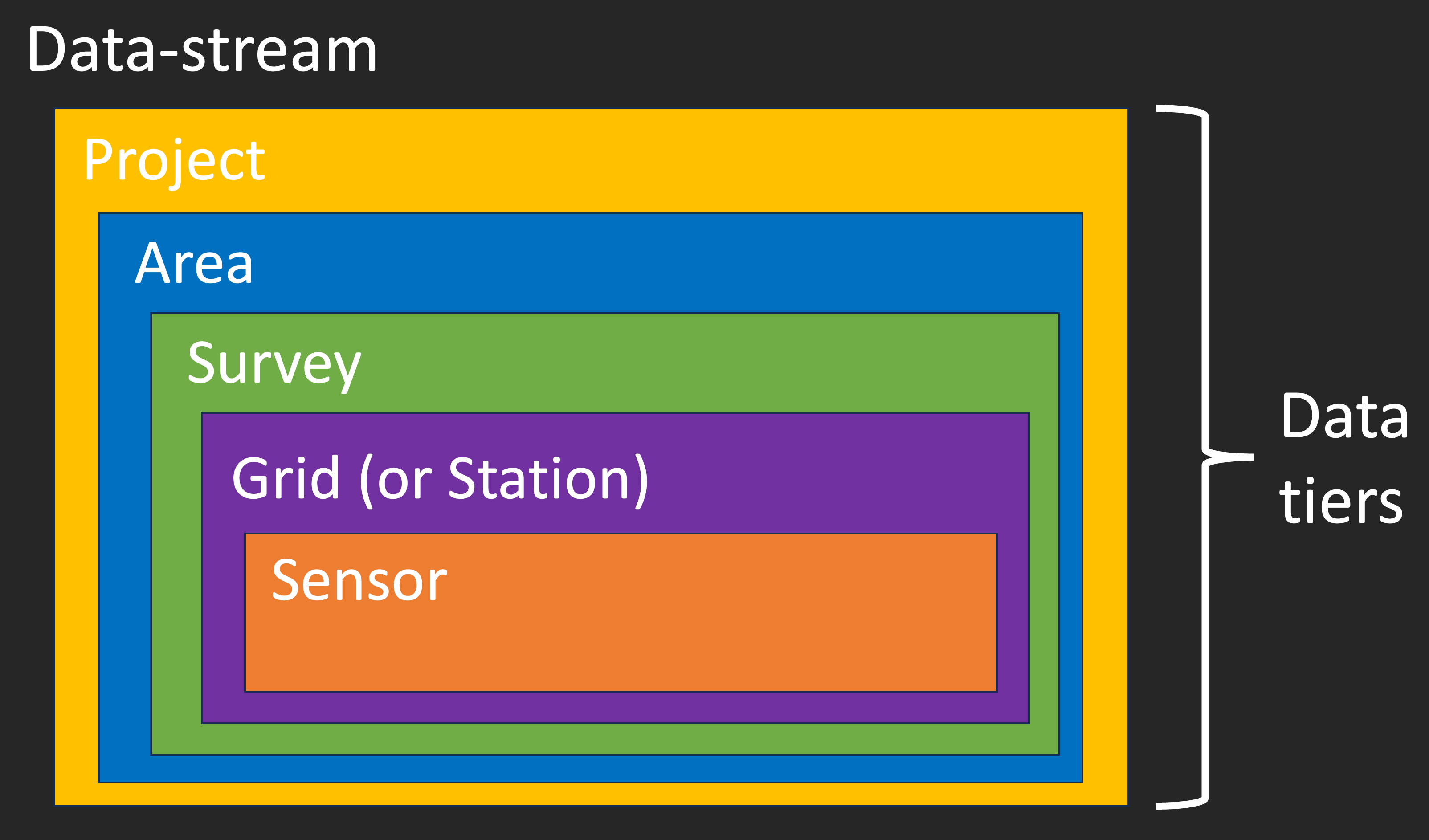
Data across Natural State should always be stored in a consistent manner. The structure of the data should be as follows:
Data-stream
    –> Project
        –> Area
            –> Survey
                –> Grid (or Station)
                    -> Sensor

Data Streams
Data-streams comprise the different types of data, and their structure, that are collected by Natural State. Data-streams can be broken down into five data-tiers:
Projects
Projects represent the top-level abstraction for Natural State data sets. Projects are geographically agnostic, and often focus on a specific conservation theme. Projects are pre-registered entities, and are comprised of one or more areas.
Areas
Areas represent the second-order abstraction (beneath Projects) for Natural State data sets. Areas comprise discreet and measurable geographic locations. Areas are pre-registered entities, and are comprised of one or more surveys.
Surveys
Surveys represent the third-order abstraction (beneath Areas) for Natural State data sets. Surveys comprise spatio-temporal arrays of wildlife sensors (e.g., camera traps, acoustic sensors, aerial photography). Surveys are on-the-fly entities (i.e., they are dependent on the data that comprises them), and are comprised of one or more grids.
Grids (or Stations)
Grids/Stations repsent the fourth-order abstraction (beneath Surveys) for Natural State data sets. Grids comprise geographically discrete geohashed zones that are used to spatially index data. Grids are on-the-fly entities (i.e., they are dependent on their scale), and are comprised of one or more data points.
Sensors
Sensors represent the fifth-order abstraction (beneath Grids) for Natural State data sets. Sensors comprise the lowest level of abstraction for Natural State data sets. Sensors are pre-registered entities.
Camera trapping example:
Camera trapping data’s lowest level of abstraction remains individual camera trap sensors. These sensors are aggregated during a survey by camera trapping stations. Stations are aggregated during a survey by grids–typically one station per grid, or a cluster of stations per grid (if required). When storing camera trapping data, we always store the raw sensor data (i.e., images) within camera folders, which are stored within station folders (i.e., a proxy gird-level), which are stored within survey folders, which are stored within area folders, which are stored within project folders. Here is an example of the file structure:
Project (RBP)
    –> Area (LLBN – Lewa Loldiaga Borana Ngare Ndare)
        –> Survey (CT_LLBN_20230121_20230325)
            –> Station (sb49hct_1; acting as a proxy grid)
                –> Camera (17cebef6-065b-4300-87a8-5f44bbd1e700)
                    –> Image (17cebef6-065b-4300-87a8-5f44bbd1e700_20230121_20230325_0001.JPG)
RBP – Rangeland Biodiversity Project
LLBN – Lewa Loldiaga Borana Ngare Ndare
CT_LLBN_20230121_20230325 – Camera trapping survey in LLBN from 21st January 2023 to 25th March 2023
sb49hct_1 – geohash ID of the camera trapping station
17cebef6-065b-4300-87a8-5f44bbd1e700 – Camera folder name
17cebef6-065b-4300-87a8-5f44bbd1e700_20230121_20230325_0001.JPG – Image Filename
All other data types across Natural State should follow this structure. If you are unsure about how to structure your data, please contact Ross Pitman (rpitman@naturalstate.org).