
Design Document - Carbon Pool Plots
KEY DETAILS
- Principal Investigator
- Drs. Nikki Stevens, Kate Parr & Catherine Machungo
Date - 23 April 2025
Version - 1.0.0
Programme - Rangelands Carbon Programme
Study Site - Lewa-Lolldaiga-Borana-Ngare Ndare (LLBN)
Key partners - LCNR; University of Liverpool; ICRAF; University of Cape Town
Contact email - cmachungo@naturalstate.org
1. PREAMBLE
Natural State’s objectives and activities are governed by a set of accepted Design Documents (DDs). These documents describe the context and purpose of all Natural State projects. Each DD documents key project details, the objective and background of the project, features of the study area, and the general methodological framework. Specific methodological details may be found in the project Standard Operating Procedures (SOP) which is available in the Related Documents section below.
2. GLOSSARY
3. PROJECT OVERVIEW
3.1 PROJECT AIMS
The Carbon Pool Plots survey aims to:
- Quantify aboveground and belowground carbon stocks across herbivory regimes.
- Collect training data for remote sensing models of carbon stocks.
- Identify the most robust and cost-effective methods for validating predictive models of carbon stocks in rangelands.
3.2 PROJECT BACKGROUND
Natural state is working to develop impact monitoring systems for aboveground and belowground carbon to enhance transparency and accountability in carbon projects reporting. Natural state is implementing the Carbon Pool Plots (CPPs) to investigate patterns in carbon stocks in relation to herbivory regimes and to generate data required for development of remote sensing-based models for prediction of changes carbon at scale as well long-term monitoring of carbon cycling in savanna systems.
3.3 STUDY AREA
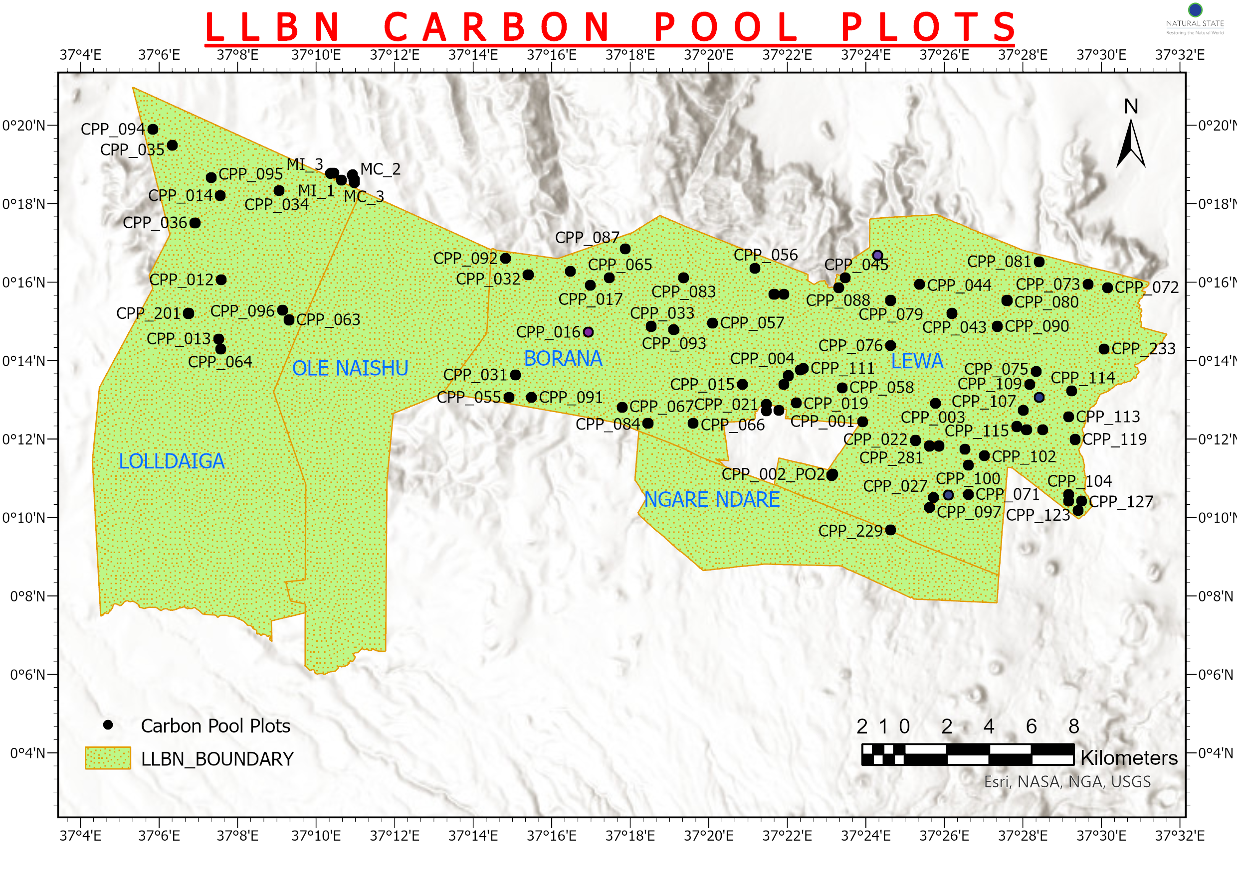
The Lewa-Lolldaiga-Borana-Ngare Ndare (LLBN) study site is a savanna rangeland landscape in the central highlands of Kenya that extends north from the lower slopes of Mt. Kenya, straddling the boundary between Meru and Laikipia counties. The four main properties are located at 0.11 = 0.34° latitude and 37.07-37.53° longitude.
Rainfall is highly variable, but is typically between 400 and 600 mm annually. During droughts, total annual rainfall can drop below 200 mm. Rainfall generally follows a north-south gradient with more rainfall at higher elevations in the south. The landscape sits at 1400-2370 m with higher elevations in Ngare-Ndare forest and south-central Lolldaiga and the lowest elevations in Lewa and northeast Borana. Soil types are highly variable throughout the landscape but consist primarily of Luvisols (Haplic and Vertic) and Dystric Regosols. Vegetation communities are predominantly Acacia-Commiphora bushlands and thickets with montane forests at higher elevations (Dinerstein et al. 2017).
Each of the four core properties are subject to divergent management practices. Lewa Wildlife Conservancy is mostly owned by The Nature Conservancy but has a number of small, privately owned enclaves. The reserve is almost exclusively used for photographic tourism but does have some livestock grazing, especially along the community road and in a section nicknamed ‘Bosnia’ where the community have grazing rights. Over the last 30 years, the conservancy has increasingly adopted elephant and large-mammal exclosures as a major management practice aimed at increasing tree cover on the conservancy.
Lolldaiga ranch is principally a livestock ranch but is also used by free ranging wildlife. Historically, the ranch was intensively grazed but recently new management has implemented a regenerative grazing regime based on intensive grazing by a few large, fast-moving herds. The grazing regime is intended to stimulate grass productivity and prevent selective grazing by livestock herds.
Borana Conservancy is a dual use wildlife and livestock ranch that also includes privately owned enclaves. In addition to photographic tourism, the conservancy produces cattle and has a partnership with a local community that extends limiting grazing rights to community herders. Borana has a few large-mammal exclosures, especially along the river that runs between Lewa and Borana.
Ngare-Ndare forest is a state forest reserve but is managed by the Ngare-Ndare Forest Trust on behalf of six villages. The Trust administers sustainable use of the forest by the six communities, predominantly for firewood collection and grazing. The forest also has small-scale tourism operations. The forest is predominantly populated with wild olives and junipers.
North of Lewa, Borana, and Lolldaiga are several community conservancies that practice predominatly pastoral lifestyles as well as the Mukogodo Forest, which is a forest conservancy managed on behalf of four neighboring communities. On the western boundary of Lolldaiga Ranch is Kupona, a small experiemental plot for testing restoration interventions.
The study area also includes the Maiyanat Community Conservancy (formerly “Makurian”) that abounds Lolldaiga to the North. It stretches westward from the northwest corner of Borana in a wedge shape nestled between Ole Naishu Conservancy and Mukogodo Forest, bordering Uaso Nyiro to the west. The conservancy primarily sustains pastoral livelihoods. In recent years, the conservancy has initiated some small-scale restoration pilot projects by fencing off degraded and eroding hillsides and constructing erosion prevention measures such as swales or semi-circular bunds. The conservancy has sandy soils and a high prevalence of invasive Opuntia cacti and erosion gullies.
3.4 PROJECT TIMELINE
Field sampling is divided into Phase 1 and Phase 2. Phase 1 consisted of an initial survey of 80 plots sampled between October 2023 and March 2024 with Phase 2 continuing on indefinitely.
4. SURVEY DESIGN
4.1 SPATIAL DESIGN
Survey sites were chosen using a combination of manual selection and stratified random sampling. Non-random sites included all 18 Global Ecosystem Monitoring (GEM) Network sites in the LLBN landscape as well as some manually selected sites to capture compromised land cover including sites in Maiyanat (with and without interventions) and Ngare-Ndare Forest.
For the stratified random sample, the landscape was discretised using level 7 geohashes (~150 m X 150 m) with the centroids of geohashes used as the set of available locations for CPP centroids. Geohashes that encompassed rugged terrain (defined as having a Terrain Ruggedness Index (Riley, 1996) value of 40 or higher based on 90 m SRTM digital elevation data) or straddled management units were excluded from analyses. The landscape was also split using an elevation threshold of 2000 m representing a climatic transition from savannas to forests. The landscape was then stratified according to five variables.
Managment & Herbivory The landscape was defined using 10 land use classes:
- Wildlife and minimal cattle grazing across Lewa Wildlife Conservancy, excluding elephant exclosures.
- Wildlife and managed cattle grazing across Borana Conservancy.
- Wildlife, but with reduced elephant activity, within elephant exclosures
- Wildlife, but with reduced elephant activity, within recent (2022 or later) or newly planned elephant exclosures.
- Wildlife and intensive, unregulated grazing in the Bosnia community grazing area.
- Experimental high-intensity low-frequency stocking densities and other rangeland management practices at Kupona Experimental Farm.
- Wildlife and high-intensity low-frequency grazing in sandy soils across Lolldaiga conservancy.
- Intensive, unregulated livestock with reduced wildlife in Maiyanat, including ecologically compromised areas.
- Ngare Ndare Forest.
- All other mixed-use community areas.
4.2 TEMPORAL DESIGN
Carbon Pool Plots provide a snapshot of carbon stocks at the time of sampling and sampling can therefore occur at any time. Each site can be visited once or repeatedly, though consideration should be given for seasonal variability in herbaceous vegetation.
5. SAMPLING DESIGN
Carbon Pool Plots (CPPs) measure above and below ground carbon stocks across landcover and management types as well as tree, grass, and forb diversity. The sampling protocols are modified from SEOSAW methods for African woodlands. Each CPP is 50m X 50m and is surveyed once to record data on tree species and size, grass and forb cover and diversity, and soil properties, although repeat sampling is optional for investigating changes in some carbon pools over time.
5.1 Tree measurements
Tree measurements follow the Large Tree and Small Tree Protocols. For large trees, the quarter hectare plot is divided into quadrants and every large tree, defined as having a diameter at knee height (~50 cm) of at least 5 cm, is identified by species with measurements of height and diameter at knee height of each stem recorded. Additionally, data is collected on the height and source of any damage, as well as whether the tree is alive or dead.
The Small Tree protocol records the same measurements as for large trees but sampling is restricted to five 5 m X 5 m subplots at each of the four corners and one at the centre of the plot.
5.2 Coarse Woody Debris
Coarse woody debris (CWD) is sampled following the CWD protocol. Coarse wood (defined as dead falled woody material with a diameter of at least 2 cm) is collected from four 1 m X 50 m transects.
5.3 Fine Litter
[Description Needed]
Grass and Forb Quadrats
Grass diversity, forb diversity and other ground cover metrics are recorded in 1 m X 1 m quadrats spaced 5 m apart along two transects, for a total of 20 quadrats per site.
Within each quadrat:
- All grass species are identified by species.
- All forb species are identified by species.
- Seedlings are identified by species and counted
- Dung presence is recorded by source as elephant, cow, rhino or other.
- Percent rock cover is estimated.
- canopy cover is measured using a densiometer.
- Termite sheeting is recorded as present or absent.
- Evidence of grazing is recorded as present or absent.
- Percent bare soil is estimated.=
Soil Carbon
Soil carbon is sampled according to the Soil Carbon Protocol. Soil samples and a bulk density sample are collected from each quadrant. Within each quadrant, three soil cores are collected at each of three depth profiles (0-15 cm, 15-30 cm, 30-50 cm) and then are mixed together in the field to produce a single sample per depth profile from each quadrant, for a total of 12 soil samples per CPP.
Bulk density samples are collected once per quadrant using a bulk density ring.
Disc Pasture Meter (DPM)
100 DPM measurements are recorded by collecting 25 per quadrant with the field tech subjectively snaking throughout the
Fine root biomass
Termite mounds
All termite mounds within the CPP are counted and measured along the primary and secondary axis.
6. ANALYTICAL FRAMEWORK
The data collected at CPPs can be analysed in innumerable ways. The primary aim is to estimate, with variance, carbon stocks per ha in eight pools:
- soil organic carbon
- fine root biomass
- herbaceous biomass
- large trees
- small trees
- coarse roots
- coarse woody debris
- fine litter
Secondarily, the survey is intended to provide rich datasets on grass, forb and tree diversity and coarse metrics of groundcover and herbivory.
7. EXPECTED OUTPUTS
- A technical donor report on Phase 1 of the Carbon Pool Plots.
- A peer-reviewed scientific article on carbon stocks in a tropical rangeland landscape under different herbivory regimes.
- A predictive remote-sensing model of soil organic carbon stocks.
- A predictive remote-sensing model of standing carbon biomass density.
8. RELATED DOCUMENTS
8.1 STANDARD OPERATING PROCEDURE
In development.
8.2 OUTPUTS
8.3 DATA ELEMENTS
Survey Design
Data Collection
- S123 data collection form - Large Trees
- S123 data collection form - Small Trees
- S123 data collection form - Additional Survey
- S123 data collection form - Soil Carbon
- S123 data collection form - Transects
- S123 data collection form - CWD & Fine Litter
Data Layers
Dashboard
In development.
8.4 ADMINISTRATIVE DOCUMENTS
==XXX==
9. REVISION AND VERSION HISTORY AND DESCRIPTION
==XXX==
10. BIBLIOGRAPHY
==XXX==
11. APPENDICES
None.